
Framingham Neighbors Through Parcel Records
For a block-level question, the City of Framingham MapGeo viewer is the clearest starting point because it puts the subject parcel and nearby parcels in the same geographic frame. The city assessor and the Middlesex South Registry then answer separate questions about assessment and recorded instruments. No single source identifies every person around an address. An assessed owner can differ from an occupant, a mailing field can point elsewhere, and a historical street list speaks only for its own year. Treat each result as a narrow statement from its custodian.
| Source | What It Shows About a Block | Access |
|---|---|---|
| Framingham MapGeo | Selected parcel, surrounding parcels, map layers, and distance-based abutter results | Online city viewer; read the map disclaimer and verify important details |
| Framingham Assessors / VGSI | Parcel address, assessed-owner field, mailing field, and valuation data | Online city assessment tools |
| Middlesex South Registry of Deeds | Recorded or registered land searches, parties, documents, property fields, and plans | Free public search; the Cambridge office helps with older material |
| Massachusetts voter route | An individual registration response or a locally requested public list where permitted | Individual search is controlled; local production follows state rules |
| Local history collections | Dated street lists, directories, maps, and community context for a former block | Library and repository research, with year-specific limits |
Start with the lot that can be located on the map. The information around it is more reliable when the radius, map date, and record type are logged. Do not turn a nearby parcel or a matching surname into a claim that people know one another.
Note: Parcel adjacency is a geographic result, so the map distance should remain part of every written description.
Mapping a Framingham Block
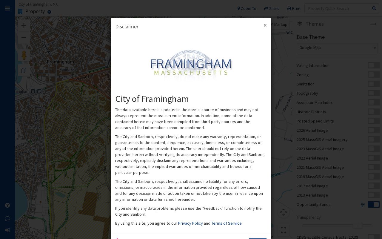
Framingham’s MapGeo property viewer offers Quick Search, a map selection tool, themes, print and share controls, and a parcel preview. The viewer’s search guidance says Quick Search generally accepts owner name, street address, or an ID number. It can also combine attribute filters or spatial filters. This is a parcel workflow, not a way to infer who visits a property or who belongs to a household there.
The city map is shown in the official MapGeo parcel view, a visual starting point for Framingham neighbors research.

Map layers and parcel outlines help establish which parcels are near the subject location. They do not establish a boundary, title opinion, or personal relationship.
Use a compact process so each step stays traceable:
- Enter the street address or parcel identifier in MapGeo and select the subject parcel.
- Record the displayed parcel identifier and the map date, then inspect only the immediately relevant surrounding parcels.
- Use the assessor data to distinguish a tax-owner field from a mailing field and from an occupancy claim.
- When a recorded instrument matters, use the Registry’s property or party search and retain its book, page, document type, and recording date.
- Use the Framingham street directory only when the question expands from the immediate block to the full named street’s records trail.
Framingham Neighbors and MapGeo Abutters
MapGeo’s abutters tool provides the most defensible nearby-parcel function. Select one or more parcels, enter a distance in feet, and choose Find. The map highlights nearby or adjacent parcels in red and places a purple distance polygon around the search area. It can provide a CSV, mailing-label output, or an Abutters Report. The distance is only a geometric filter. It does not show a social relationship, permission to contact someone, a family link, or a person’s presence at the property.
The MapGeo abutters workflow illustrates the distance-based approach used for Framingham neighbors records.
The highlighted set should be described as nearby parcels or abutting parcels. It is not a list of people, and private owner mailing fields should not be copied into a block summary.
For a property question, the Middlesex South Registry of Deeds is the next source for recorded-land, registered-land, plan, party, document, town, date, book, and property searches. The public portal has an Unindexed Property Search for Books 1 through 1024. Framingham’s historic-home guidance says most twentieth-century deeds are digitized, while material around 1900 or earlier may require the Cambridge office. That is a practical comparison of access channels, not a precise cutoff for every series.
Framingham Neighborhood Context
Neighborhood names add useful place history but do not redraw parcel lines or postal geography. The official Choose Framingham list names Downtown, Nobscot, Saxonville, Tech Park, Golden Triangle, Route 9, and Framingham Center. The city’s transportation planning material uses related labels for planning areas. Use these names as context for a block and confirm an actual address in city GIS and USPS tools rather than assigning a neighborhood label to every nearby parcel.
Choose Framingham’s neighborhood list is the source for the location labels pictured for Framingham neighbors context.
The list supplies a shared vocabulary for place, not a comprehensive association roster or a directory of people. Research did not find a unified city-maintained association or HOA roster, so a group’s status and contact page need checking before use.
| Nobscot | City material places the village around Edgell, Water, and Edmands Streets and describes an older village pattern followed by a 1950s suburban boom. |
|---|---|
| Saxonville | The area lies north around the Sudbury River and has Nipmuc, John Stone, and nineteenth-century textile-mill context. |
| Downtown | Official material identifies Coburnville, Lokerville, South Framingham, and Tripoli within its historical context. |
| Framingham Centre | Pheasant Hill, Salem End, and Woodcrest Acres are named within the broader Centre label. |
Downtown Framingham Inc and Friends of Saxonville are community or preservation leads, while the Framingham History Center and League of Women Voters appear in established local material. They are best used to understand local history and civic context, not as person directories.
Framingham Neighbor Records and Voter Access
The Massachusetts Voter Registration Search asks for first name, last name, date of birth, ZIP, and an agreement checkbox. It confirms an individual registration response when the supplied fields match. It is not designed to browse a block by street address. The Framingham City Clerk can receive a request for a local public voter list, while statewide voter-file access is limited to specified recipients under MGL c.51 §47C. Format and cost depend on the office and production.
Confidential voter registration can keep a protected voter’s name and residence off street lists, annual registers, and public disclosure. A court order, protective-shelter basis, or police-chief affidavit can support that protection, and the affidavit itself is not public. An omission from a public list does not prove that someone is absent from the block or not registered. Keep a voter response separate from assessor ownership, a Registry party, or an occupancy claim.
Historical street lists can serve a different purpose. The Framingham Public Library holds early-twentieth-century List of Polls and Street Lists with residents from 1920 forward. Each is a dated snapshot with its own eligibility rules, so it can support a past-block question without being used as a present-day roll.
Comparing Framingham Block Sources
Official records and commercial neighbor-search tools work differently. An official system identifies its custodian, source class, and stated scope. A commercial category may combine records of varying dates, so its claims should be checked back to the city, Registry, court, or state source that produced the underlying fact. No result set should substitute for the original custodian’s record when an address, ownership question, or safety concern needs verification.
| Official record route | Commercial neighbor-tool category | How to use the result |
|---|---|---|
| MapGeo and assessor data identify parcel and assessment fields. | May combine place and name material from several dates. | Check parcel fields against the city source and keep the map date. |
| Registry records identify an indexed legal instrument. | May summarize a transaction without the document context. | Inspect the Registry image or request a copy from the custodian. |
| Voter and court systems apply their own access limits. | May not show why a field is missing or dated. | Respect confidentiality and never treat a gap as proof of absence. |
For correction or removal concerns, start with the office that maintains the source record. For a commercial listing, use that service’s own privacy procedure, keep the confirmation, and recheck because a listing can return after a later data update.
Note: A block map is strongest when each fact can be traced to a city, Registry, court, state, library, or other named custodian.
Framingham Neighborhoods Have Layers
A street, parcel, neighborhood label, and ZIP are related but separate geographic layers. A street can cross more than one local context, and a neighborhood label is not a legal boundary. Postal codes are delivery constructs rather than city lines. The research recognizes 01701 through 01705 for Framingham, with 01701 and 01702 as standard delivery codes and 01703 through 01705 as postal or PO Box codes. That pattern does not assign every parcel to a neighborhood.
MapGeo supports the parcel layer. USPS normalizes a mailing address and ZIP. The Registry records a property’s town and legal description. Keeping those sources separate avoids a common error: treating an address’s ZIP or an abutter radius as a statement about a person. The Massachusetts Interactive Property Map can be a statewide comparison tool, but city MapGeo remains the more direct Framingham parcel source.
Framingham’s historic geography adds a useful caution. Saxonville grew around a waterfall-powered textile mill, while Downtown holds several older village labels and Nobscot shifted from village form to a suburban pattern. Changes in land use and local naming can make an old address or community reference harder to align with a modern map.
Privacy for Framingham Neighbors
Good block research deliberately leaves out sensitive material. Do not publish full date of birth, SSN, phone, email, unit number, private mailing field, protected address, financial data, or a person’s routine. A parcel card can have a mailing address that does not belong in a public block summary. MapGeo itself warns that data may not be up to date, can come from third parties, and should be independently verified with the city or a licensed professional.
The Massachusetts Address Confidentiality Program supplies substitute addresses and mail forwarding for eligible people who have relocated or fear disclosure. A directory must never attempt to reverse one. Court records also have protected identifiers, and juvenile, medical, abuse or harassment, and impounded matters have further restrictions. The public-record request process does not override those limits.
Lawful personal use. Use parcel and block information for family history, civic curiosity, a property question, or an informed safety concern. Do not use information about Framingham neighbors to stalk, harass, intimidate, or harm anyone.
Massachusetts criminal-harassment and stalking statutes are found in MGL c.265 §§43 and 43A. When a fact is important, confirm it with the office that maintains it and keep the lookup limited to the real question.